Garmin Montana 710, Rugged Outdoor GPS Touchscreen Navigator (010-02963-00)
Garmin Montana 710, Rugged Outdoor GPS Touchscreen Navigator (010-02963-00)
SKU: 010-02963-00
Stock bas
 Afficher tous les détails
 WhatsApp
 SMS - Text us!
 Email Us!
 Help Desk
Avis
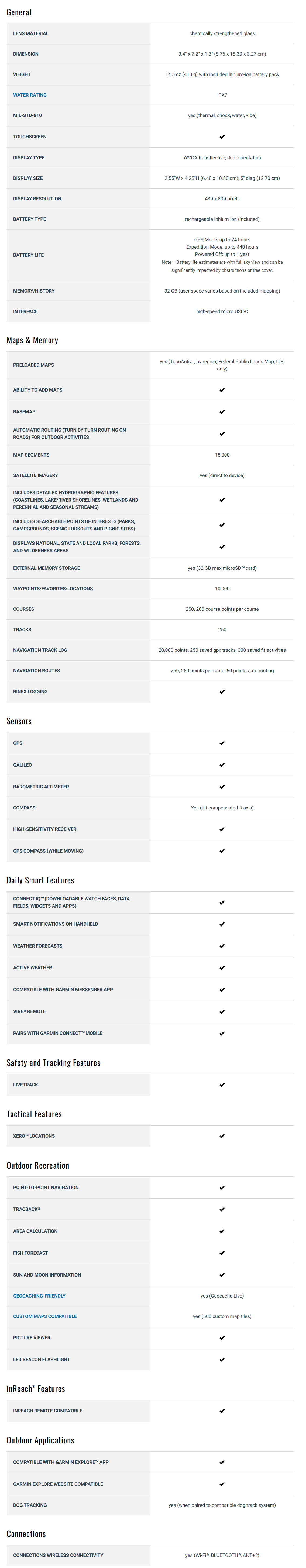
Spécifications
Dans la boîte
High capacity lithium-ion battery pack
USB cable
Documentation
Manuel et garantie
 Garmin Warranty
Vous avez un vieux GPS qui traîne ? Le programme Trade In and Up de GPS Nation est un excellent moyen d'échanger votre ancien GPS usagé contre un crédit pour l'achat d'un nouveau GPS. Le choix vous appartient entièrement ! Nous avons simplifié et rationalisé le processus. Suivez ces étapes simples et vous serez sur la bonne voie pour recevoir un crédit pour votre tout nouveau GPS !
1. Obtenez un devis
Pour obtenir votre devis gratuit, indiquez le type, le fabricant, le modèle et l'état de votre GPS. Dans les 24 heures, vous recevrez un devis correspondant à la valeur de reprise de votre produit actuel. Le formulaire de reprise/d'échange de GPS se trouve au bas de cette page.
2. Expédiez votre/vos produit(s) pour le commerce
Après avoir accepté notre offre, emballez votre ou vos produits en toute sécurité et expédiez-les-nous à l'aide de l'étiquette d'expédition prépayée qui vous a été fournie. Nous vous enverrons un e-mail de confirmation lorsque votre échange arrivera à notre entrepôt. Vous disposez de 30 jours à compter de la date à laquelle vous avez terminé votre échange en ligne pour expédier le produit à GPS Nation.
3. Effectuez votre achat
Une fois que nous aurons reçu votre produit à notre entrepôt et que nous aurons validé l'état indiqué, nous vous enverrons un e-mail de confirmation. Si vous choisissez de recevoir un crédit pour un nouveau GPS sur gpsnation.com, votre crédit de magasin sera émis et vous serez libre de procéder à votre achat.
Avis
Poser une question
Spécifications
Dans la boîte
High capacity lithium-ion battery pack
USB cable
Documentation
Manuel et garantie
Programme d'échange
Vous avez un vieux GPS qui traîne ? Le programme Trade In and Up de GPS Nation est un excellent moyen d'échanger votre ancien GPS usagé contre un crédit pour l'achat d'un nouveau GPS. Le choix vous appartient entièrement ! Nous avons simplifié et rationalisé le processus. Suivez ces étapes simples et vous serez sur la bonne voie pour recevoir un crédit pour votre tout nouveau GPS !
1. Obtenez un devis
Pour obtenir votre devis gratuit, indiquez le type, le fabricant, le modèle et l'état de votre GPS. Dans les 24 heures, vous recevrez un devis correspondant à la valeur de reprise de votre produit actuel. Le formulaire de reprise/d'échange de GPS se trouve au bas de cette page.
2. Expédiez votre/vos produit(s) pour le commerce
Après avoir accepté notre offre, emballez votre ou vos produits en toute sécurité et expédiez-les-nous à l'aide de l'étiquette d'expédition prépayée qui vous a été fournie. Nous vous enverrons un e-mail de confirmation lorsque votre échange arrivera à notre entrepôt. Vous disposez de 30 jours à compter de la date à laquelle vous avez terminé votre échange en ligne pour expédier le produit à GPS Nation.
3. Effectuez votre achat
Une fois que nous aurons reçu votre produit à notre entrepôt et que nous aurons validé l'état indiqué, nous vous enverrons un e-mail de confirmation. Si vous choisissez de recevoir un crédit pour un nouveau GPS sur gpsnation.com, votre crédit de magasin sera émis et vous serez libre de procéder à votre achat.
Aperçu
Garmin Montana 710 Rugged GPS Touchscreen Navigator (010-02963-00)
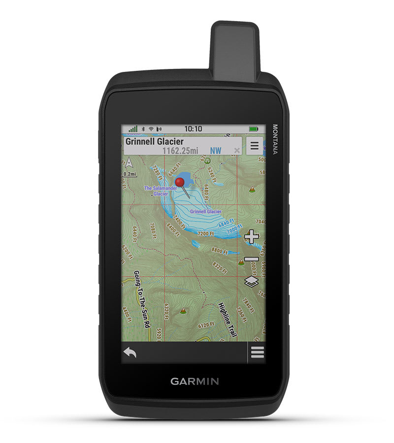
The Montana 710 is the ultimate handheld GPS device for rugged adventures. Designed for use on foot, bike, kayak, ATV, and more, it combines advanced navigation features with a sturdy 5-inch touchscreen that’s glove-friendly and built to last.
Key Features
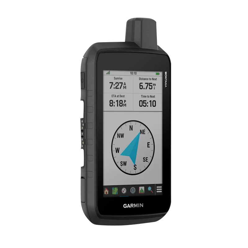
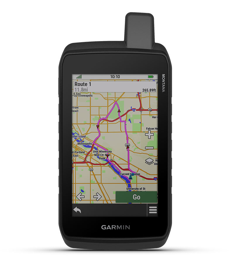
LARGE 5-INCH TOUCHSCREEN
- Navigate effortlessly with a bright, glove-friendly touchscreen that delivers visibility and usability, even in harsh environments.
RUGGED BY DESIGN
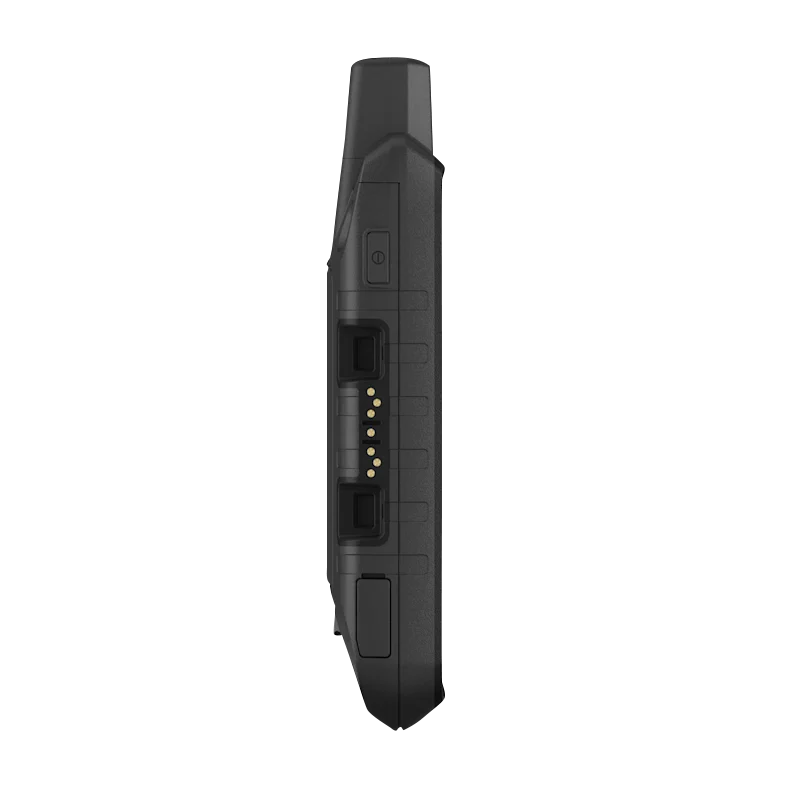
- Tested to MIL-STD 810 standards for thermal, shock, water, and vibration resistance.
- Compatible with a variety of rugged mounting solutions (sold separately).
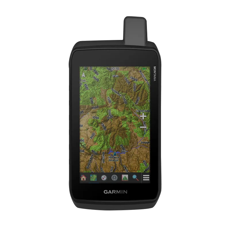
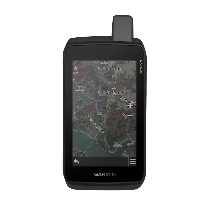
TOPOACTIVE MAPS & SATELLITE VIEWS
- Preloaded worldwide topographic maps with terrain contours, elevations, coastlines, rivers, and landmarks.
- Enjoy vivid, subscription-free satellite imagery with direct-to-device downloads over Wi-Fi.
SUPPORTS OUTDOOR MAPS+
- Access premium mapping content with an optional Outdoor Maps+ subscription, providing regular updates via Wi-Fi.
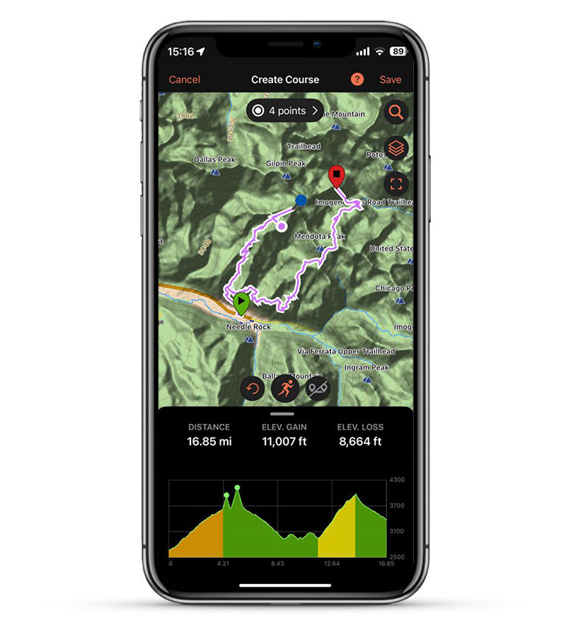
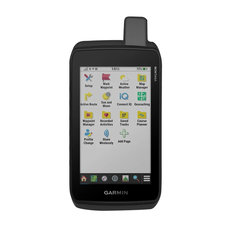
GARMIN EXPLORE™ APP
- Plan, review, and manage your trips with the Garmin Explore app, including waypoints, routes, and activities.
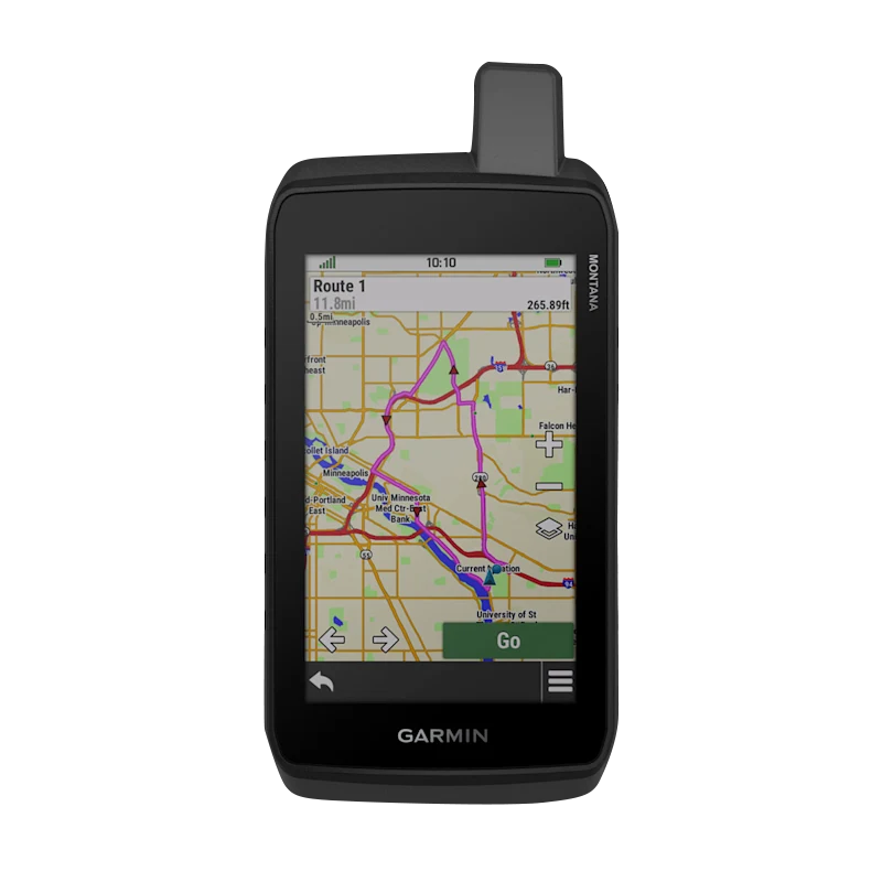
Navigation Features
MULTI-GNSS SUPPORT
- Track in challenging environments with access to GPS and Galileo satellite networks.
ABC SENSORS
- Navigate trails with an altimeter (elevation), barometer (weather monitoring), and a 3-axis compass for precise orientation.
ACTIVE WEATHER
- Stay ahead of the elements with up-to-date weather forecasts via the Garmin Connect™ app.
DOG TRACKING
- Hunters and trainers can sync the Montana 710 with compatible Astro® or Alpha® handhelds to track sporting dogs in the field.
WIKILOC TRAILS
- Access hiking, cycling, and other trails shared by the outdoor community through the preloaded Wikiloc app. Enjoy a free 60-day Premium trial to explore exclusive features.
Adventure Features
PUBLIC LAND BOUNDARIES
- Display federal public land boundaries on maps to ensure you stay within permitted areas.
EXPEDITION MODE
- Trek off-grid with ultralow-power GPS tracking, enabling the Montana 710 to operate for over two weeks between recharges.
BATTERY OPTIONS
- Choose between a rechargeable lithium-ion battery pack (24-hour battery life in GPS mode) or traditional AA batteries (not included).
VEHICLE MOUNTS
- Adapt your Montana 710 for use on ATVs, boats, cars, motorcycles, RVs, and more with a range of compatible mounts .
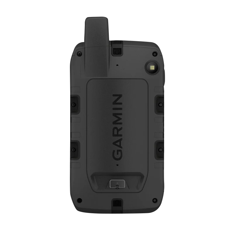
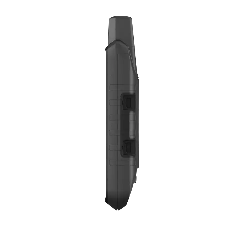
RUGGED BY DESIGN
This durable, water-resistant handheld is tested to meet MIL-STD 810 for thermal, shock, water and vibration. It features a glove-friendly 5-inch touchscreen and is compatible with a variety of robust mounting solutions (sold separately) to best suit your activities.
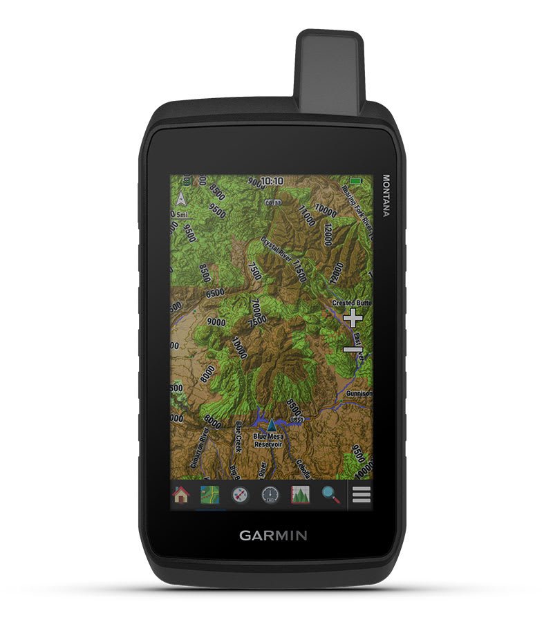
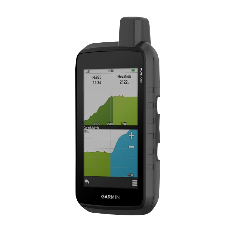
TOPOACTIVE MAPS
To navigate your adventures, use preloaded worldwide topographical maps. View terrain contours, elevations, coastlines, rivers, landmarks and more.
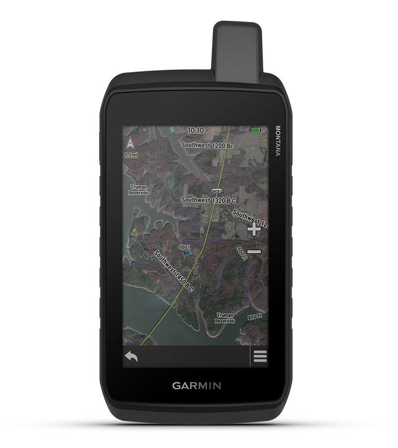
SATELLITE VIEWS
Access subscription-free, high-resolution satellite imagery with direct-to-device downloads over Wi-Fi® connectivity. See photorealistic overhead views of routes and surrounding terrain, and easily create waypoints based on landmarks.
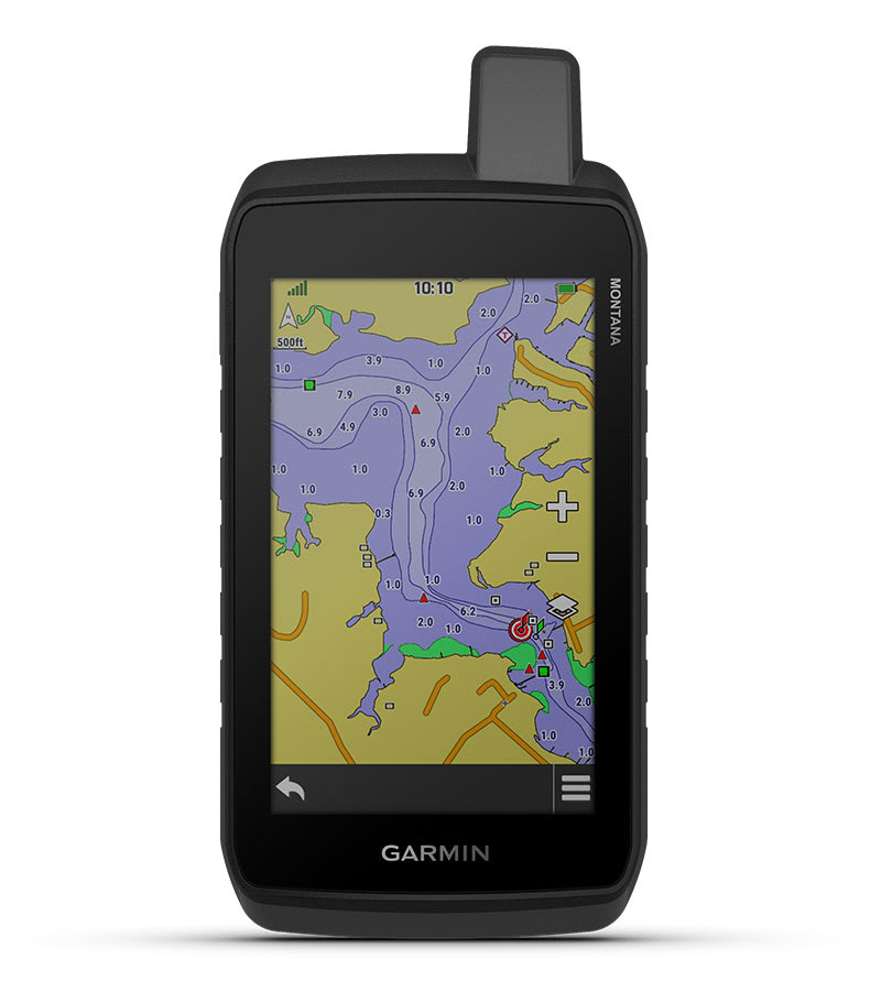
ADDITIONAL MAPS
With 32 GB of onboard memory, you can download even more maps, such as City Navigator® maps for your drive or BlueChart® g3 charts for the water (sold separately).